
Why did the Vancouverite consider moving to Penticton permanently? Because in the Okanagan language, Penticton means “a place to stay forever”!
Surrounded by the beauty of vineyards and the warmth of the community, the meaning of Penticton’s name resonated deeply. It felt like discovering a sanctuary—a place where time paused, inviting us to stay forever.
Ready to embark on your own adventure from Vancouver to Penticton? Dive into our guide and let the journey begin!
- Best Time to Go
- What is the route from Vancouver to Penticton?
- How long is the drive from Vancouver to Penticton?
- Best Stops along Vancouver to Penticton Drive
- Touchdown Penticton
- Apps to Download for a Trip to Penticton
Best Time to Go
The best time to go to Penticton is early autumn. September brings you delightful days with highs reaching up to 24°C, ideal for indulging in outdoor adventures.
As the season progresses, temperatures gradually cool to a comfortable range between 5°C and 15°C, making it ideal for leisurely walks, invigorating hikes, scenic bike rides, and immersive exploration.
What is the route from Vancouver to Penticton?

Penticton in British Columbia is a charming city nestled between Okanagan Lake and Skaha Lake, renowned for its scenic beauty and outdoor recreation.
Important for its tourism industry and wine culture, it offers locals and tourists a vibrant destination for wine tasting, beaches, lakes, the channel float, and tasty peaches.
When you’re heading from Vancouver to Penticton, you’ve got two options for your route. You can either take Highway 3 or opt for Highway 5.
Here’s a quick comparison of the driving time and distance for the two routes from Vancouver to Penticton:
Highway 3 Route (via E.C. Manning Provincial Park):
- Distance: Approximately 400 km
- Driving Time: 4 hours 50 minutes
Highway 5 Route (via Coquihalla Highway):
- Distance: Approximately 420 km
- Driving Time: About 4 hours 30 minutes
If you go with Highway 3, get ready for some seriously scenic views as you pass through E.C. Manning Provincial Park. It’s like driving through a postcard with mountains, forests, and grasslands all around you.
But fair warning, most of the drive is pretty twisty-turny, with lots of ups and downs. It’s mostly just two lanes, so passing can be a bit tricky at times.
Once you hit Keremeos, Highway 3 splits, and you’ll want to take the 3A route heading northeast. Eventually, you’ll hit Highway 97 near Skaha Lake, and from there it’s a straight shot up to Penticton.
Now, if you’re feeling like taking the faster route, that’s where Highway 5, also known as the Coquihalla, comes in. But watch out, especially in winter – this stretch between Hope and Merritt gets hit with some serious snow.
Once you’re in Merritt, you’ll switch over to Highway 97C. Cruise on this road until you hit Highway 97, then just head south straight into Penticton.
How long is the drive from Vancouver to Penticton?

The drive from Vancouver to Penticton is around 400 km, with a minimum travel time of about 4 hours and 30 minutes.
Starting your adventure from Vancouver, Highway 1 serves as the quickest route to head eastward. As you make your way, keep an eye out for the pivotal decision point near Hope, roughly 120 km into your trip.
Here, you must decide between the scenic paths of Highway 3 and the efficient route of Highway 5.
Regardless of your chosen route, it’s wise to budget around 6 to 7 hours for your Vancouver to Penticton road trip. Remember to factor in time for those essential sightseeing stops and bathroom breaks.
Best Stops along Vancouver to Penticton Drive
Vancouver to Hope
Ascend the Bridal Veil Falls
Media credit: lynbuban
Address: Bridal Falls, BC V0X 1X0, Canada
Phone: +1 604-986-9371
Located at the site of the ancient village of Popkum, Bridal Veil Falls is this stunning waterfall surrounded by ancient trees. The trails there are really well-kept and easy to follow.
The hike itself takes about 10 minutes, with just a few small inclines along the way. It’s a tad steep in spots, but the views are totally worth it! And when the sun hits those falls, it’s like magic.
Visit the Quaint Town of Hope
Media credit: sforseth000
Hope has scenic beauty, small-town charm and an abundance of nature, including desert canyons, waterfalls, lush meadowlands and rainforests.
Aside from that, Hope is surrounded by towering mountains, with towering directions in every direction that make you feel tiny as you explore this quaint little mountain community.
Famous area attractions include the famous Othello tunnels, Kawkawa Lake, Flood Falls, Hell’s Gate Airtram, and many more.
Drink and Dine at Blue Moose Coffee House
Address: 322 Wallace St, Hope, BC V0X 1L0, Canada
Phone: +1 604-869-0729
This charming coffee shop downtown is a real gem, serving up a variety of espresso drinks, baked goods, and delicious sandwiches.
We tried their mocha and a berry scone. The mocha had a great balance of chocolate and coffee flavors, with just the right level of sweetness.
Traverse Ladner Creek Trestle
The Ladner Creek Trestle hike is a slice of the historic Kettle Valley Railway. You’ll find the trailhead at a pullout along the Coquihalla Highway, nestled between Hope and the Coquihalla Summit.
Following the trail is a breeze, though watch out for a couple of steep bits with loose dirt. It’s about 30 minutes to reach the trestle and an old tunnel. Most of the trail’s a cinch, but be cautious for the last 100 meters or so — it gets a bit dicey.
Hope to Princeton
Explore E.C. Manning Provincial Park
Media credit: similkameenbc
Address: 7500 BC-3, Manning Park, BC V0X 1R0, Canada
Phone: +1 604-668-5953
E.C. Manning Park is like the crown jewel of the Cascade Mountains, smack dab between the Lower Mainland and the Okanagan, just a three-hour drive away from each.
It’s one of the best parks out there. Picture-perfect panoramas of the mountains all around, stunning alpine lakes, and during wildflower season, it’s like a colorful carpet of blooms. Plus, keep your eyes peeled for marmots and deer roaming around!
Go Stargazing at the Cascade Lookout
Media credit: manningpark
Address: 7500 BC-3, Manning Park, BC V0X 1R0, Canada
This spot is a game-changer. You get this complete 360-view of the park and the resort down below. But the real magic happens at night.
The stars are absolutely mind-blowing. Hands down, one of the prime stargazing spots in BC. Hardly any artificial light messing with the view—just pure, unadulterated cosmic beauty.
Princeton to Penticton
Dine at the Copper Pit
Address: 157 Vermilion Ave, Princeton, BC V0X 1W0, Canada
Phone: +1 250-295-3305
You’ve gotta check out Copper Pit—it’s a full-on Southern-style dining experience. Their bar is fully stocked with 12 different draught beers, including Guinness and a killer lineup of 11 local craft brews.
If you’re asking us, go straight for the Pit Master Feast. You get a little taste of everything—brisket, pulled pork, ribs, sausage, and chicken.
Camp at Bromley Rock Provincial Park
Media credit: _karlisa_
Address: Okanagan-Similkameen H, BC, Canada
Phone: +1 250-766-7972
At Bromley Rock Campground, you’ve got a total of 17 drive-in campsites and 19 spots for picnics, all tucked under the shade of Douglas fir and cottonwood trees.
Whether you’re stopping for a quick breather or planning to camp overnight, this place is more than just a pit stop.
Stop by the Village of Keremeos
Address: Keremeos, British Columbia, Canada
Phone: 250-499-2711
Keremeos, nestled among the Similkameen River and mountains, is an agricultural gem. It’s surrounded by sprawling orchards, vineyards, and farms as far as the eye can see.
If you’re a fan of fresh produce, you’ve hit the jackpot. Keremeos proudly wears the title of the Fruit Stand Capital of Canada.
Take in the View at Highway 97 Viewpoint
Media credit: vonrayz
One more tip before you go: make a quick pit stop at the Highway 97 viewpoint. You won’t regret it! From there, you’ll catch some awesome views of the lake and get a glimpse of the stunning Skaha Bluffs Provincial Park.
Hope to Merritt
Cool Off at Britton Creek
Media credit: leal4580
Hands down, the top rest spot on your journey has got to be Britton Creek, about 58 kilometers or 40 minutes from Hope.
Here, you’re surrounded by lush forest and towering mountains. Plus, the facilities are spacious, have clean washrooms, and bonus points for Wi-Fi! And because it’s not right next to the highway, you won’t have to deal with all that noise.
Roam Around Coquihalla Summit Recreation Area
Media credit: stephrw
Address: Coquihalla Hwy, Yale, BC V0K 2S0, Canada
Phone: +1 800-689-9025
The Coquihalla Summit Recreation Area is an absolutely gorgeous place to visit. If you’re planning to hike or camp here, leave those heels and flip-flops at home because proper footwear is a must, and don’t forget to gear up right.
In the summer, the road’s in tip-top shape, so no worries there. And for you anglers out there, there’s some great fishing spots too.
But let’s talk views—jaw-dropping doesn’t even begin to cover it. You’ll be treated to some of the most stunning mountain vistas and peaks around.
Walk Around Merritt
Merritt is a hidden gem nestled in the Nicola Valley of BC’s south-central Interior. This place is a nature lover’s dream.
It has countless wilderness lakes just waiting to be explored. And they’re not just for camping. Other activities here include wildlife spotting, birdwatching, canoeing, kayaking, windsurfing.
Merritt to Peachland
Appreciate the Laurie Guichon Memorial Grasslands Interpretive Site
Media credit: kirstenpendreigh
Address: Lundbom Rd, Aspen Grove, BC V0E 2R0, Canada
If you’re cruising down Highway 97C, you’ve gotta make a pit stop at the Laurie Guichon Memorial Grasslands Interpretive Site. There’s this easy-peasy 750-meter trail that leads you straight to a viewing platform overlooking a serene pond.
And hey, whether you’re a die-hard birder or just a traveler looking to soak in the beauty of the Nicola Valley’s grasslands, this place has got you covered.
Traverse the Pennask Summit
Media credit: mdstratts
Address: Central Okanagan, BC V0H 1X0, Canada
Pennask Lake, nestled at a high elevation, is truly a marvel with its multiple spring creeks feeding into its pristine waters. The park encompasses two bays situated at the southeastern corner of the lake.
However, reaching this destination involves a challenging ascent up to Pennask Summit, followed by a gradual descent on the other side. It’s a journey that demands some stamina, but the breathtaking scenery along the way makes it all worthwhile.
Peachland to Penticton
Make a Quick Stop to Hardy Falls
Media credit: chantallestretch
Address: South of Peachland on Hwy 97 across from Antler’s Beach
Here, you’ll embark on a leisurely stroll through a charming little valley, tracing the path of a delightful creek.
Following the well-kept trail and crossing several quaint bridges, you’ll eventually be rewarded with a stunning view of Hardy Falls. It’s a simple yet enchanting walk that’s sure to leave you in awe.
Get Tanned at Sun-Oka Beach Park
Media credit: jessishortyyy
Address: Okanagan Hwy, Summerland, BC V0H 1Z4, Canada
Phone: +1 250-766-7972
At this spot, you’ll discover a picturesque sandy beach along the shores of Okanagan Lake, complete with all the amenities you could ask for. Think playgrounds, fire pits, picnic tables, and even drinking water fountains.
For the water enthusiasts, you’ll find watersport rentals available, along with washrooms and change rooms for convenience. And when it comes to swimming, you’re in for a treat—the area’s sandy and safely marked with buoys.
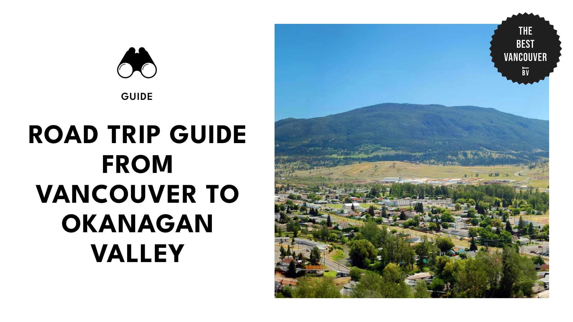
Touchdown Penticton
Walk up Munson Mountain
Media credit: shewho_wanders
Address: Penticton, BC V2A 8S5, Canada
Phone: 250-490-2400
Munson Mountain offers an incredible vantage point for taking in the breathtaking vistas of Penticton and the majestic surrounding mountains. But be prepared—it’s a bit of a steep climb, so you’ll definitely want to lace up those sturdy walking shoes.
Once you reach the top, you’ll find a short paved path leading to a shady gazebo, providing the perfect spot to catch your breath and soak in the view.
And if you’re up for it, there’s a short dirt path that takes you even higher up, offering an unparalleled panorama that’s absolutely worth the effort.
Try Out Wine Tasting on the Naramata Bench
Set amidst the picturesque foothills of the Okanagan mountains, the Naramata Bench boasts a one-of-a-kind terroir, basking in endless sunshine.
Here, you’ll discover handcrafted wines and an intimate wine-tasting experience nestled within one of Canada’s most renowned wine regions.
With more than 40 wineries dotting the landscape of the “bench,” embarking on a tour here means immersing yourself in the very heart of Okanagan wine culture.
Hiking to the Little Tunnel
Media credit: mountainmomyyc
Address: 1N0, Kettle Valley Rail Trail, Naramata, BC, Canada
Located high above the shimmering waters of Okanagan Lake, the Little Tunnel stands as a premier hiking and biking spot in the Penticton region.
While the journey to the Little Tunnel is mostly uphill, boasting a gentle 2% grade, the return trip takes only about 10 minutes. The views along the way are absolutely breathtaking, with sprawling vineyards and glistening lakes stretching out below you.
Bike the Kettle Valley Rail Trail Through the Vineyards
Address: Kettle Valley Rail Trail, British Columbia, Canada
This trail winds its way through the Boundary region, traversing the Okanagan all the way to Hope.
Originally established in 1915, the Kettle Valley Railway has since been decommissioned, but its tracks now serve as the foundation for an expansive recreational trail.
Stretching nearly 650 kilometers (or 400 miles), this interconnected pathway offers a remarkable route from Hope to Castlegar. It’s a journey through history and nature!
Apps to Download for a Trip to Penticton
Roadtrippers: turn-by-turn navigation with pre-made travel guides in Canada. Get alerts for unique attractions, local diners, scenic points, and hotels along your route.
Maps.me: detailed, offline maps with turn-by-turn navigation for driving, hiking, or biking to a selected location.
AllTrails: custom route planning app with fitness activity tracker and reviews from fellow hikers to help you plan your outdoor adventures.
GasBuddy: locates gas stations near you and shows you prices, sends you price hike alerts and the app notifies you about deals.